Our Swiss colleague Michi Bösiger went on a spectacular glacier hike through the impressive Morteratsch Glacier to the Boval hut.
The Morteratsch Glacier is an alpine glacier of the Bernina range in Grisons, Switzerland. It is framed by famous mountains such as the Piz Bernina, Piz Morteratsch, Piz Zupo and, as many alpinists say, by one of the most beautiful of all mountains, the Piz Palü.
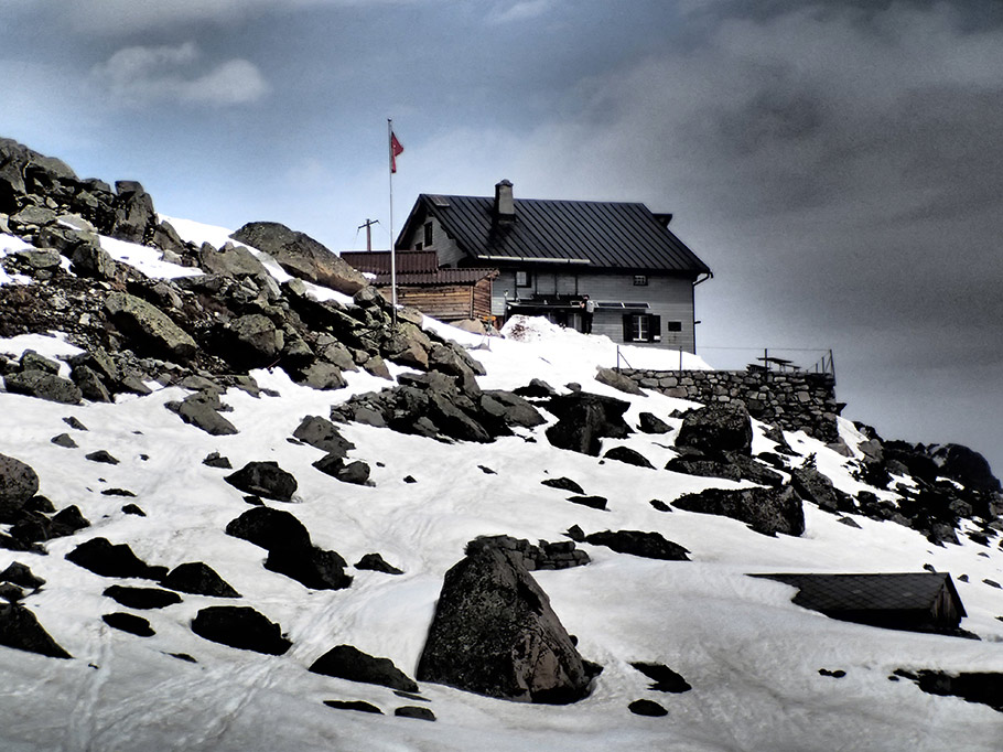
The striking path towards the Refuge Boval leads through this glacier all the way up to 2,495 metres above sea level to the Swiss Alpine Club’s hut. There is also a summer path leading towards the hut, but due to the still present avalanche risk it is not accessible yet. It is highly recommended to check with the hut warden about the conditions of both paths prior to your trip. And of course, make prior accommodation reservations. When choosing the glacier version as mentioned above, mountaineering experience is needed.
Together with the inflowing Pers Glacier, the “Vadret de Morteratsch”, as it is called by the locals, forms the glacier with the highest volume in the Eastern Alps reaching about 1.2 cubic kliometres. Ever since observations began in 1878 it has lost 2.2 kilometres in length but is still the third longest glacier in the Eastern Alps with 6.4 kilometres. Its surface measures an impressive 15.3 km².
Starting point of our glacier hike is Pontresina above St.Moritz. When traveling by train, you’ll have to get off at “Morteratsch” (1,896 m.a.s.l.) or, when going by car, park it right there. In the beautiful forest nearby there is also a camping site located.
The glacier hike can beginn
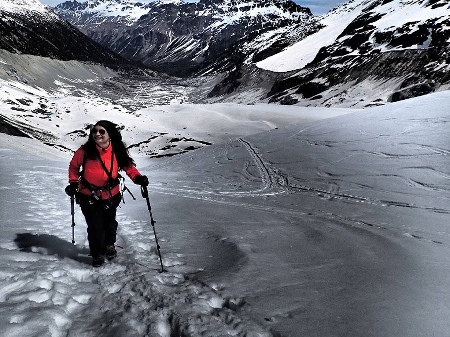
We start early in the morning, equipped with everything we need for a glacier hike: climbing irons, ice pick, climbin harness, short climbing rope. As I suspect a lot of snow on the glacier, we also pack snowshoes. (Those will not be needed from June on, of course.)
Also interesting: Skitouring for Beginners – Preparation, Equipment, Hazards
Our path leads us past an aromatic smelling spruce forest. There is also an educational glacier trail that explains many interesting facts about this area in 20 stations. Furthermore, you find signs along the hiking trails that document the glacial retreat. After we have crossed the glacial stream we reach the glacier snout, where we fixate our climbing irons and the harness.
On one side we can see ski tracks leading down from the Diavolezza hut. Our ascent tracks, however, lead along the right side and are also easily spotted. Rather flat in the beginning, they become steeper and lead past deep crevasses and brooks. The whole scenery is completed by rocks lying and also constantly falling down on both sides of the glacier basin.
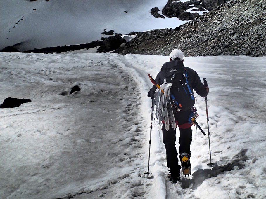
The warming of the melting permafrost can be spotted easily: Those loud, deep and archaic sounds make me shiver and remind us to not get too close to the moraines. The glacier’s middle part consists of many crevasses and should not be crossed now as many of the crevasses are still covered in snow and thus cannot be seen. After one last steep ascent, we can now see the hut above us sitting enthroned on a rock.
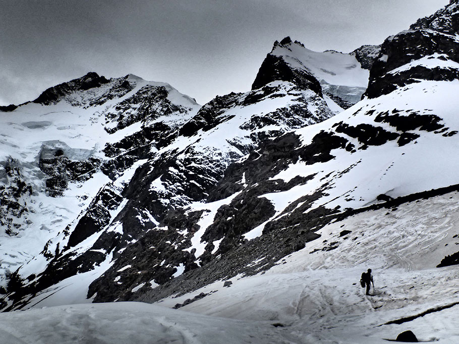
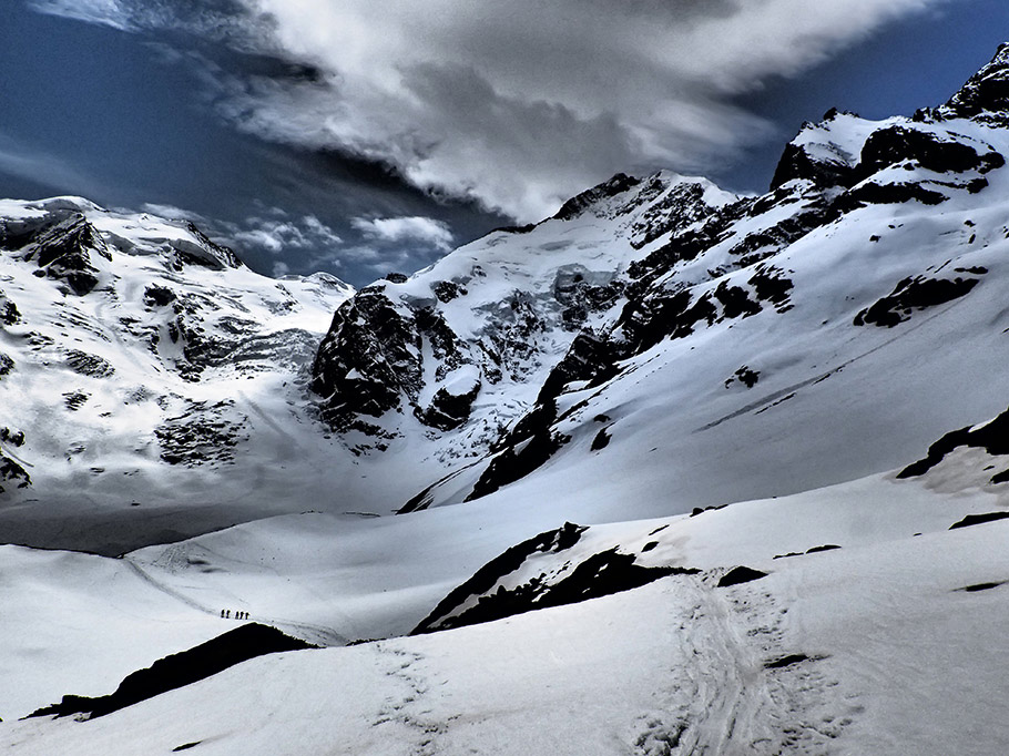
I know that there is still a loop waiting for us so we can enjoy a little break first and enjoy the fantastic setting. Our eyes are magically drawn to the famous Biancograt, which we have only recently climbed, and we are gazing at the huge, blue reflecting, steep crevasses on all mountain faces. On the other side of the valley, the Piz Cambrena and the famous Piz Palü, consisting of three summits, rise majestically. We think fondly of this ascent as well.
At the hut’s terrace we meet other ski tourers, who already enjoy the brilliant panorama. First, we quench our thirst and chat with Roberto Costa, the friendly hut warden – his home-made risotto is a vision! After a great evening in the hut with new acquaintances, delicious red wine and interesting conversations, we move into our dorm, which only provides simple blankets. We won’t decide before tomorrow morning which hut will be our next destination as the weather forecast warns of a break in the weather. We have two possibilities: We can either take the glacier route towards the Diavolezza top station or the one via the Boval pass towards the Tschierva hut.
Also interesting: Ski Tour Haute Route – From Zermatt to Arolla – Dream tour for professional ski tourers
We got up surprisingly well rested the next morning and enjoyed our breakfast. It has turned warmer, which won’t make the upper glacier tour not very pleasant. The glacier glints in an intense gold as the wind has brought Sahara sand over night.
Like several other tourers, we decide to go back because the active front is clearly noticeable and approaching quickly. The descent using the climbing irons in the softened ice is somewhat more exhausting than yesterday and we have to be very careful to not break through hidden holes below the softened ice. The second we reach the car it starts raining heavily. We have made the right decision once again!
Facts
Start: Train station Morteratsch 1,896 m a.s.l.
Destination: Refuge Boval 2,495 m a.s.l.
Metres in altitude: 599
Hiking time: Summer trail approx. 2 1/2 hrs, glacier trail approx. 3 hrs
Information
www.meteoblue.com/de/schweiz/wetter-pontresina
Hiking maps: Ski tour map 268S Julierpass, 1277 Piz Bernina
Coordinates Refuge Boval: 791151 / 143445
Coordinates Diavolezza: 794239/ 143224
Coordinates Tschierva hut: 787725 / 142090
Equipment
- Complete glacier equipment
- Multi-layered weather protection wear, sun glasses, sun screen
- Hiking boots with good grip
- Snacks / drinks
- Cash for the hut; SAC/DAV/ÖV membership cards
- Mobile phone
- First-Aid Kit
Text: Michi Bösiger; Outdoor Guide, Tatonka Switzerland
Photos: © Caroline Micaela Hauger; Olympus Ambassador Switzerland


