Running through California, Oregon and Washington to the Canadian border, the Pacific Crest Trail (PCT) is one of those long-distance trails that almost all hikers dream about half their lives, but only a small number actually venture on. To help you dream (or plan!), we’ve put together a hiking guide that introduces you to the highlights and gets you started planning your trail.
The Pacific Crest Trail is one of three Triple Crown long-distance trails: the Appalachian Trail and Continental Divide Trail also traverse the U.S. on a north-south axis, and together they make up the three longest and sometimes most challenging long-distance trails in the country. 2,650 miles (4,265 kilometers) through a wide variety of landscapes attract thousands of hikers each year. A few of them even venture to hike the entire trail – and even fewer (the thru-hikers) actually manage to hike the entire long-distance trail in one season.
These dry facts alone are enough for many ambitious hikers to check flights, equipment, and annual vacations. And we haven’t even begun to talk about the absolutely stunning scenery, the immense athletic challenge, the cohesive, family-like hiking community, or the famous American hospitality. No matter where you are on the PCT, you’ll encounter at least one of these things.
The nature
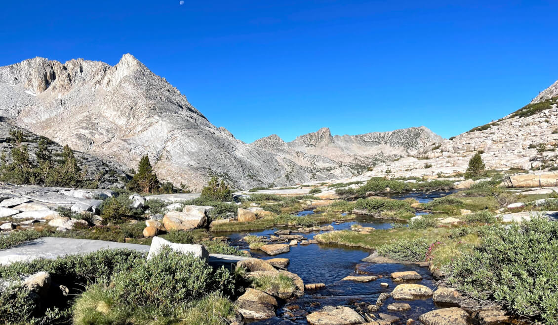
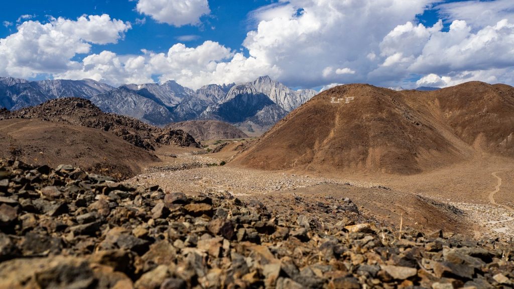
The arid desert of Southern California is just about bearable in spring and fall and provides amazing diversity despite the lack of water – especially for us Central Europeans, this is certainly one of the most exotic sections of the PCT. The undisputed queen of the PCT, however, is the High Sierra, which demands everything of its visitors with dizzyingly high mountains (including the highest point in the continental U.S., Mt. Whitney, 4,421 m), dramatic passes, moon-like landscapes and extreme weather. You’ll pass through three national parks on this section, including the world-famous Yosemite National Park. Northern California (NorCal) is not quite as high in elevation and is clearly marked by volcanic activity (especially in Lassen Volcanic National Park). You’ll also find some nice little towns here that score points with festivals, craft beer, and good (read: tons of) food, especially in the summer.
Only a small part of the PCT runs through Oregon, passing many volcanoes and the impressive Crater Lake National Park. The final highlight is the absolute wilderness and the North Cascades National Park in Washington State, where you have to expect a lot of precipitation, snow and numerous glaciers – but also the towering, snow-covered mountains, glacial lakes and the feeling of being all alone in the world.
Preparations
Probably the most important preparation for the PCT is not an equipment battle, but simply training. Inexperienced hikers should by no means enter the High Sierra or Washington and expect this to be comparable to a high-altitude hike in the Alps. Some of the terrain is very challenging. Especially in spring, you must expect wet, treacherous snowfields, some of which will sink you to your waist – and that’s with at least 20 kg of pack on your back because of provisions. There are some fords that can be life-threatening to traverse depending on last winter’s snowfall. On many southern sections of the PCT there is very little or no water. You will need to carry your food for days at a time as there are often no aid stations.
Be aware of the sections you want to hike and don’t underestimate the dangers – the PCT is known as one of the toughest trails in the world for a reason.
But of course, your gear has to fit, too. For long-distance trails, the rule is: as light as possible, as little as necessary. Expect to be shouldering water and food for several days in some cases. Be sure to try as many pairs of shoes as possible to save yourself at least some of the blisters and calluses the trail will inevitably give you. Reading a few hiking guides about the Pacific Crest Trail, as well as the numerous blogs that circulate on the Internet, will help you get a realistic picture.
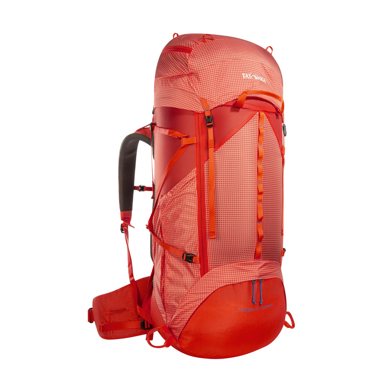
Our Yukon LT is the perfect backpack for strenuous trekking tours. Available with 50+10 liters volume in a special women’s version or as a unisex model with 60+10 liters volume. With numerous practical features and made of extremely tear-resistant and ultra-light material.
Our packing list
As soon as you start thinking about long-distance hiking, you will quickly come across the term “base weight”. Base weight is basically the weight of your gear without food and drink, but it can be interpreted differently: Some long-distance hikers also don’t count clothing as part of the base weight, as this also varies depending on what you’re currently wearing on your body and what’s in your backpack.
A good basic equipment is in any case:
- Warm, light sleeping bag (depending on the climate zone)
- Water filter
- Rainwear
- Sleeping clothes (merino) – otherwise no change of clothes
Another interesting approach is to base weight not on gear, but on food. Instead of counting grams, it should be calories that determine what’s in your pack. More room for food means optimizing your calorie intake.
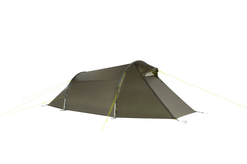
Our Gargia 2 is a very lightweight tunnel tent with special comfort features. With its 2.35 meter long inner tent, even tall people can fit comfortably.
Also, what kind of food you take with you is crucial: hot food requires cookware, but gives you more variety and helps you stay warm and keep going in cold sections. Cold food like energy bars, chocolate, fruits and vegetables are easier to carry, but won’t warm you up and you can overeat on them quickly. Our tip: Take dried vegetables with you and soak them in water. This way you will not only run weight optimized, but also eat healthier than most hikers.
The best websites and apps for the PCT
FarOut is the absolute leader when it comes to long-distance hiking trails like the PCT. The app includes the entire trail length of the Pacific Crest Trail, allows for offline navigation, and has many supply points and water replenishment stations that are maintained by users on a daily basis.
The PCT Water Report is a free database that documents water occurrences and snowfall. Hikers on the trail can report new or depleted water reservoirs via email, helping to keep this vital report current.
Postholer is another very informative source of snow reports.
The Route
If you are one of the brave ones who want to do the whole trail, the route is clear: either south-north (like more than 90% of your fellow hikers) or north-south. If you want to experience only a part of the PCT, perhaps in combination with an extended vacation in the USA, there are several factors that can influence your choice of the appropriate section.
Your arrival or departure point
There are several cities through which you can reach the Pacific Crest Trail. Popular destinations for visitors to the USA are Los Angeles (for Southern California), San Francisco (for Central and Northern California), Portland (for Oregon), Seattle (for Washington) or Vancouver, Canada. Here you need two visas, one for Canada, one for the USA. However, this can be worthwhile, as Vancouver is a great city and always worth a visit – just like the Rocky Mountains, which are not far away. You can read more about Canada in our Backpacker Guide Canada.
Your preferred climate
Do you prefer it dry and warm? Do you love deep forests and rain doesn’t scare you? Do you get altitude sick easily or is hiking without four-digit elevation gain a walk in the park for you? Since the PCT is so diverse, it has it all – you’re spoiled for choice!
How much time do you have?
The Pacific Crest Trail is, of course, doable in much smaller sections than over its entire length. Many people also do easy day or weekend hikes on sections of the trail, preferring to experience the diversity and splendor of the PCT one bite at a time rather than quitting their job and dropping out completely. Multi-day sections of one or two weeks are also absolutely possible.
Hiking the Pacific Crest Trail: Three Suggested Routes
We assume with our route suggestions that you feel like spending a larger part of your time in the USA in the wilderness and therefore suggest three routes in different sections of the PCT, ranging from five days to two weeks in length. An Internet search, especially on English-language sites, will give you even more good ideas to combine with your trip.
Two weeks Sierra: Horseshoe Meadow to Mammoth Lakes
Start: Horseshoe Meadow (2.7 km north of PCT mile 744.5, elevation: 3,036 m)
End: Red’s Meadow Store (0.5 km north of PCT mile 906.7, elevation: 2,371 m)
Length: 264 km
Elevation gain: +9,428 m/-10,246 m
Note: You need a Bear Can for this section – bears live in the Sierras and you need to protect your food from them. Bear Cans are mandatory for all hikers on this section and can either be purchased or rented. However, thanks to the internet, this is not a problem: a quick search will let you find one.
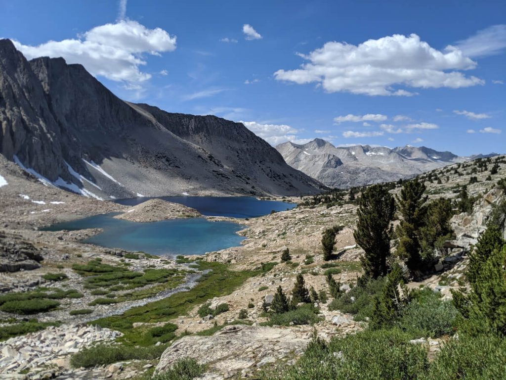
This hike is the picture-perfect section of the Pacific Crest Trail and takes you over most of the major Sierra passes, including Forester Pass – the highest point on the trail at 10,999 feet (PCT 779.5). If you make it to Mammoth, you’ll also cross Glen Pass (3,641 m), Pinchot Pass (3,700 m), Mather Pass (3,687 m), Muir Pass (3,649 m) with the iconic century-old Muir Hut, Selden Pass (3,325 m), and Silver Pass (3,276 m).
This section is both the most strenuous and most beautiful of the PCT. You will face countless ups and downs through challenging terrain, you will most likely have to trudge through snow and (depending on the snow conditions in the winter before) cross not so harmless streams. In return, the barren, rocky High Sierra with its mountain lakes and expansive views is absolutely stunning.
If you get a permit to climb Mt. Whitney, you can also start (or end) this hike at Whitney Portal. You’ll hit the PCT at 36 km from Horseshoe Meadow, but crossing the Whitney Portal adds another 23.5 km and a lot of elevation gain (a summit climb adds 6.1 km of distance).
At some point on this hike, you’ll need to stock up on supplies (unless you’re carrying a huge amount of food or traveling very fast). This can be done via a hike over Kearsarge Pass to Independence at PCT 788.9 (24.4 km detour with 35.4 km hitched), over Bishop Pass to Bishop at PCT 831 (19 km detour with 35.6 km hitched), at Muir Trail Ranch at PCT 857.7 (2.6 km northwest of the PCT – NOTE: very strict requirements), or at Vermilion Valley Resort (VVR for short).
Maybe you won’t have as much time as you imagined on this hike due to stocking up on supplies to just enjoy the Sierra outdoors? That doesn’t matter, because you have the option of saving about 40 km by either starting the hike by crossing Kearsarge Pass and heading north from PCT 788.3 or ending the hike at VVR.
Or do you have more time? If so, you can hike all the way to Tuolumne Meadows in Yosemite – with another 57.6 km past Red’s Meadow. If you’re considering this, though, you might as well just hike the equally great John Muir Trail, since you’re almost even in terms of distance at that point.
5-7 days NorCal – Enchanting nature and a music festival
Start: Belden (PCT mile 1,284.3)
End: Drakesbad Guest Ranch (PCT mile 1,347.6)
Length: 101.8 km
Elevation gain: +3,886 m/-2,841 m
Note: This section is below the growth limit for Poison Ivy (poison ivy). Take care of your (uncovered) arms and legs!
Northern California (NorCal for short) doesn’t boast the big highlights of the Pacific Crest Trail compared to trail favorites the Sierras and Northern Cascades. The area is still enchanting, though, and also more accessible than many other sections of the PCT. Travelers who don’t live in the U.S. can hike part of the trail here without much logistical hassle. Also, this section is lower than other parts, making it a good choice for people prone to altitude sickness – there are still enough ascents and descents, as well as enchanting landscapes like Lassen Volcanic Park or Mt. Shasta.
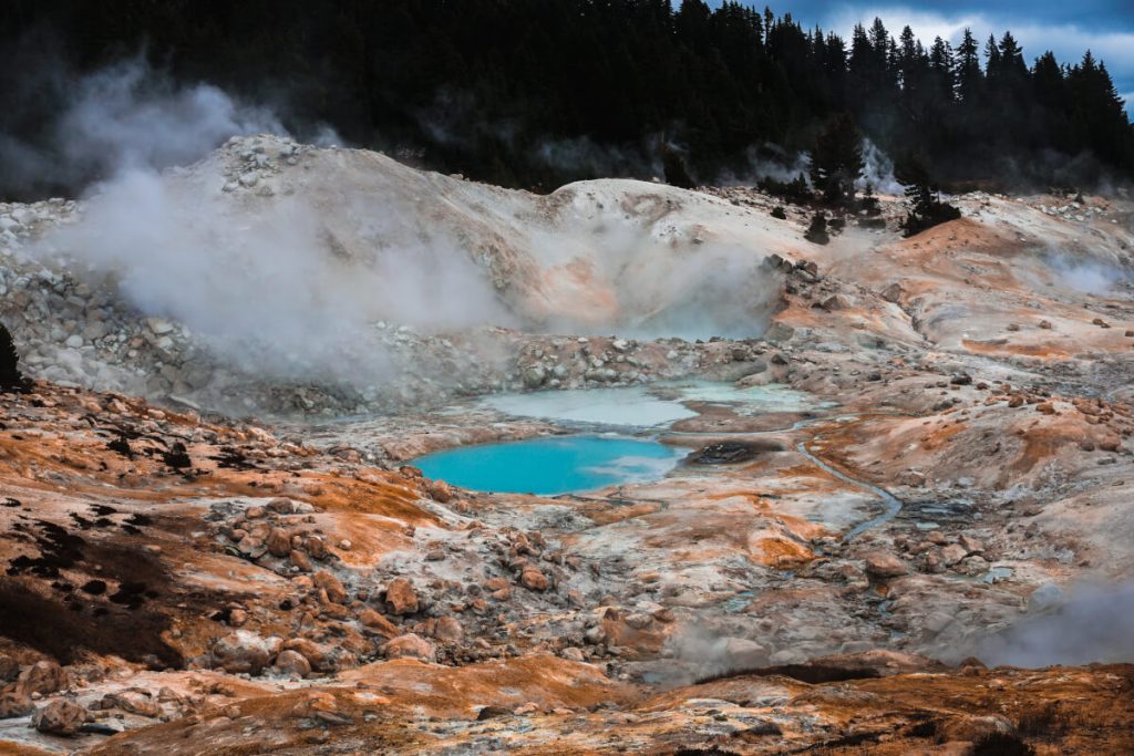
The town of Belden, your starting point for this route, is known for its annual music festival (in August). If you want to meet some people and listen to the stories of the Thru-Hikers, this is the place to be – or you can head straight out and get a serious fitness lesson right away.
From Belden, you’ll immediately begin the climb that Thru-Hikers sometimes complain about the most. The first 22.8 km are mostly uphill as you climb 1,845 m (with a descent of 378 m). There should be enough water on the trail for the first 16 km, in case you want to reduce your carrying capacity for the climb by taking less water with you.
After 58.6 km, you’ll reach the midpoint of the Pacific Crest Trail (PCT 1,320.7/2,203 m). Although the midpoint of the PCT has been moved a few times (and the actual midpoint is more likely at PCT 1,325.1/7.1 km north of the actual marker), you will pass it in this area. Not long after the marker, the trail passes Highway 36 (PCT 1,328.8/1,528 m). The town of Chester is 12.1 km east of here. If you want to stop your hike early, this is just the place to do it. From here you can either walk to Chester or hitch a ride.
The trail climbs from the highway and now heads toward the border of beautiful Lassen Volcanic National Park (PCT 1,343.8/1,801 m). In this one, there are tons of trails you can tack on if you don’t want to stop yet and don’t feel like a major extension – Drakesbad Guest Ranch (the northern terminus of this hike) is only 4.5 km away. Drakesbad (PCT 1,347.6/ 1,737 m) has coin-operated laundry facilities, showers, and a restaurant. It is accessible by paved road (private vehicles are allowed). If you can arrange to be picked up from here, your hike ends here.
If you feel like spending a full week in NorCal, you can also extend this hike 37.5 km to Old Station – which, incidentally, is the better exit point from the Pacific Crest Trail. Old Station is a small town with amenities including a store, motel, and post office, and is connected to a thoroughfare. Just before you reach Old Station, it’s worth taking a short detour north on a small loop trail that leads you through an underground volcanic lava tube.
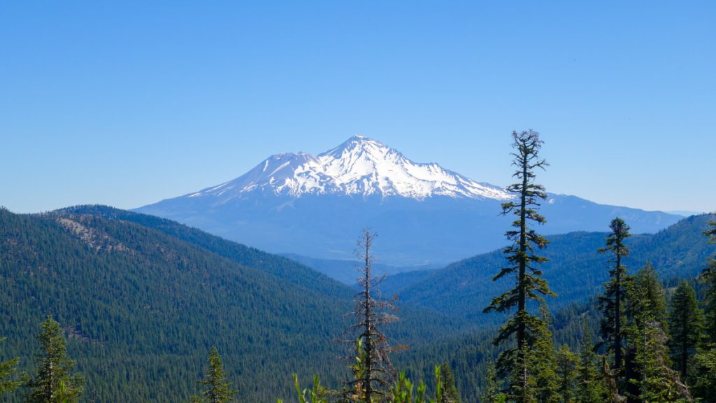
10 days Washington – pure wilderness
Start: Rainy Pass / Hwy 20 (PCT mile 2588.3)
End: Stevens Pass / Hwy 2 (PCT mile 2,476)
Length: 199 km
Height difference: +6,980 m/-7,240 m
Washington and especially the North Cascades National Park is the most popular section of the Pacific Crest Trail after the Sierras. On this section you will understand what the word “wilderness” means: here you are really far away from civilization, surrounded by stunningly high mountains, mountain lakes, glaciers and depending on the season quite extreme weather (yes, we mean snowstorms). This section is for the hardy – but as always, the hardships are worth it for the unforgettable nature experience that awaits you.
You’ll find far fewer hikers here compared to the more southerly sections, but also fewer aid stations and camping options. In the North Cascades National Park (PCT 2,585.2- 2,569.1), you need a special (free) permit to pitch your tent – and it’s only possible in certain places. Be aware of the route and sensible daily stages beforehand, as well as where to stock up on food.
Start at the Rainy Pass parking lot just off Highway 20, and after about 26 kilometers you’ll reach the High Bridge Ranger Station (PCT 2,569.4/491 m). From here you can take a shuttle (17.7 km) to Stehekin ($7 one-way, see website for details) to stock up on provisions. However, food choices in Stehekin are rather limited (and quite expensive). This is where logistics come into play. You can send your supplies ahead to the Stehekin Post Office (+1 509-699-2015) and pick them up when you get here. Here’s the address:
(hiker name)
c/o General Delivery
Post Office
Stehekin, WA 98852
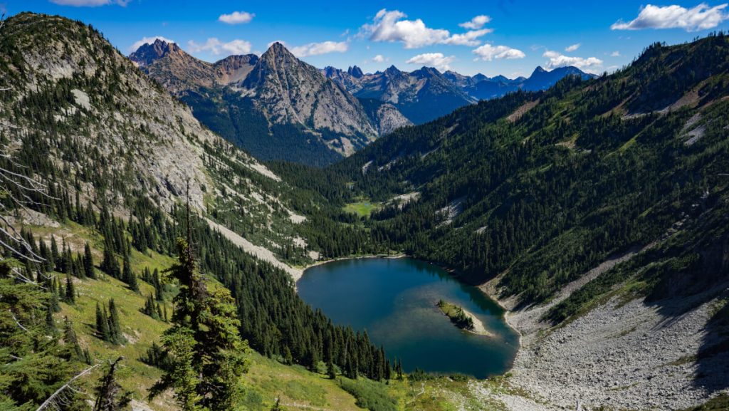
If you find in Stehekin that you don’t want to go any further, you can take a ferry from here across Lake Chelan back to (near) civilization. For the next 173 kilometers, you won’t have a chance to resupply or leave the trail (at least not without calling in air support).
South of High Bridge, the trail flattens out for a while – with less than 1,219 meters of elevation gain in more than 17 kilometers, an absolute relief before the next section. Now the highs and lows of Washington are in full effect as you run through the Glacier Peak Wilderness and the Henry M Jackson Wilderness to the southern terminus of this hike: Stevens Pass on Highway 2. From here, it’s very easy to get back to Seattle (or Everett) – just hitch a ride or have someone pick you up.
If you want more, you can either hike the route south to north to the Canadian border to the northern terminus of the PCT, or continue south from Stevens Pass to Snoqualmie Pass.


