Our Swiss colleague Michi Bösiger, experienced outdoor enthusiast and educational adventure trainer, presents an impressive hiking tour through the virtually untouched Greina High Plain, a nature conservation area in the Swiss Alps. In two days of full-power hiking or in three more comfortable days, the route takes you from the mountain canton of Graubünden (Grisons) to southern Tessin (Ticino).
Greina
The Greina Pass (Italian: Passo della Greina) is an Alp crossing from north to south which was already used by the Romans. It reaches a height of 2,355 m above sea level.
The Greina plain (in the local language: Plaun la Greina) is a high plain around six kilometers long and one kilometer wide at a height of about 2,200 meters. This untouched natural landscape became famous through protests throughout the country against a hydro power station project with dam in Greina. The biotope diversity of the plain is extraordinary and unique.
There are many starting points and possible tours in this region. A most attractive possibility is the pass crossing from the Swiss mountain canton of Graubünden to the southern Swiss “Mediterranean” canton of Tessin. This tour is not difficult for experienced mountain hikers. The route can also of course be taken in the opposite direction.
Also interesting: Glacier Hike Switzerland: Between Glacier and Heaven – a glacier hike through the Morteratsch Glacier
The hike
A good idea before starting your tour in Vrin is to enjoy the regional speciality; a slice of fine Bündner Nutcake with a cup of coffee to built up your strength!
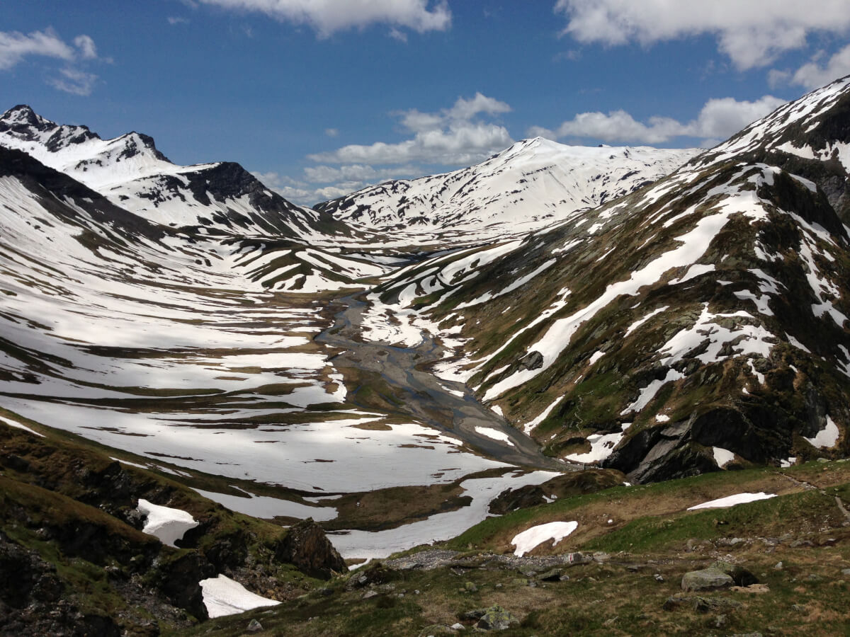
First we walked along the roadside to the hamlet S. Giusep. Now the route took us through meadowland to Puzzatsch. Here begins the steep upward climb to the Diesrut Pass, the “Entrance Gate” to the famous Greina Plain. From here there is an incredible panorama view over this high plain, which reminded me of the plains in Tibet or the Altiplano in Bolivia.
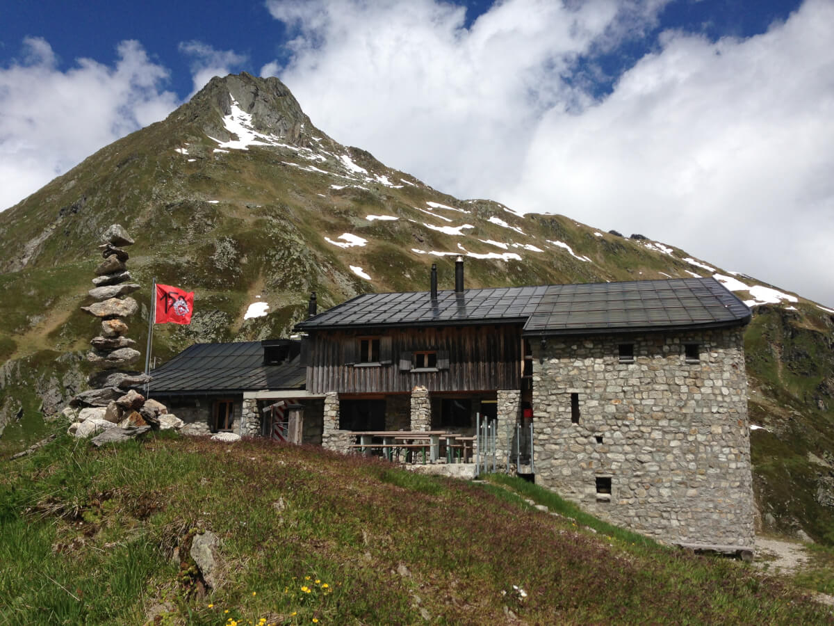
From now on it is a relatively steep uphill hike. Our telescope sticks work wonders and our knees are very grateful for them. When we reached the plain we crossed the stream and then there was around 50 meter altitude difference up and down along the rock face. Some difficult parts have been secured by chains by the Terrihütte (Hütte – chalet) wardens. We spent the night in the beautifully situated Terrihütte with wonderful views.
The High Plain of Greina, with the mountain stream Rein da Sumvitg, its rock pools and tiny lakes is a unique unspoiled landscape. The spectrum of colors and the infinite variety of terrain are extremely impressive. In this landscape of rare remoteness we found a place next to a mini lake and sat there, gazing in fascination at the original nature scenery.
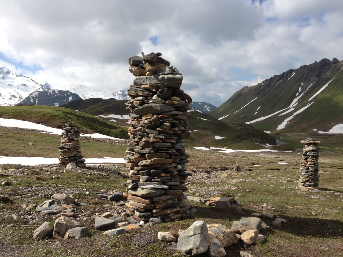
The “stone man” in black clay slate at the Passo della Greina (2357) gave us the impression of a Tibetan signpost. From here you can see the Piz Corói and the Medelser mountains.
Here it is interesting to see the conspicuous change in the landscape from the north to the south side of the pass. I personally will never forget the view from the south side down to the Lago di Luzzone. The route continues down through a magnificent pine and larch forest and then directly along the lakeside to a tunnel.
You definitely need a little courage to go along this stretch of about 600 meters, even though the route is an existing trail. The head lamp helped us. A special highlight is then finally of course the well-earned cappuccino in Campo Blenio in Tessin, and time to reflect on the many lovely impressions.
Tip
I have also hiked through this area on snowshoes in winter (see photo, just before the Terrihütte). On this occasion my route led from the Greina pass to SAC[1] Medelserhütte. To do this in winter however, requires more experience, good orientation and of course knowledge of avalanches. It is therefore recommended that for this tour in winter you should book a guide from a mountain climbing school (for example: www.bergundtal.ch; www.castor.ch; www.grindelwaldsports.ch).
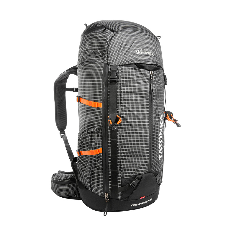
Outdoor equipment in high quality
At Tatonka you can find outdoor equipment for your next tour. No matter whether backpacks, ponchos, gaiters, tents, cooking utensils or first aid.
Itinerary
Day 1- approx. 5 hours, uphill 1150 m, downhill 450 m
Vrin 1470m – S. Giusep – Puzzatsch 1667 m (1 hour) – Diesrut Pass 2428 m – Point 2194 m – Terrihütte 2170 m
From Vrin we have to take the tarmac road for approx. 2.5 km to S. Giusep (restaurant). From S. Giusep lovely meadow path shortcuts take us to Puzzatsch.
Possible shortcut: Go by Bus Alpin (booking essential: Tel. 0041 79 483 83 69). We can go to Puzzatsch on this bus. From Puzzatsch there is a gravel path to the stream crossing Aua da Diesrut and then the ascent on the mountain path to Diesrut Pass. There are lovely views over the Greina landscape.
Descent to the plain at 2194 m. After crossing the stream there is again a steep up and down stretch – 50 meter – along the rock face. Some difficult parts have been secured by chains by the house wardens so that even less practiced mountain hikers can reach the Terrihütte safely. Overnight stay in the SAC-Terrihütte.
Day 2 – approx. 6 hours, uphill 200 m, downhill 1160 m
Terrihütte 2170 m – Greina Pass 2358 m – Scalettahütte SAC 2205 m – Ghirone Pian Geirett 2012 m – Fontana S. Martina 1565 m – Daigra 1408 m – Campo Blenio 1216 m
From the Terrihütte the route ascends to the right of the rocks of Muot la Greina to the Greina High Plain. At the wooden bridge (possible alternative route in the direction of the Motterasciohütte / Luzzone Reservoir) we continue walking straight ahead via the Greina Pass to the Scalettahütte.
After a break here, we first go back the same way for about 5 minutes, over the stream and then to the west along the steep downhill slope in to the valley bottom Pian Geirett.
From Pian Geirett in the main season there is a bus at the weekends and during the holiday season daily (reserve seats!). Along the way there are various possible shortcuts for hikers; pay attention to the signposts! Shortly before Fontana S. Martina we chose to take the road for about half and hour to Daigra. From Daigra there is lovely hiking trail to Campo Blenio.
Day 3
After the Greina Pass there is the possibility of a further overnight stay in the SAC Scalettahütte, without a warden. In this mountain hut you must bring your own food.
Information
- Start: Vrin 1448 m above sea level, coordinates: 727.161 / 168.431
- Destination: Campo Blenio 1215 m above sea level; coordinates: 714.894 / 157.095
- Highest point on the hike: Passo della Greina (2359 m above sea level), coordinates: 716.543 / 163.243
- Level of Difficulty: sporty, T2
- Map: 1233 1:25000 GREINA
- Places to visit: Vrin, S. Giusep, Greina mountain hut, Campo Blenio
- Places to stay overnight: SAC Terrihütte, Telephone: 0041 81 943 12 05 coordinates: 719.950 / 166.000
- Additionally on the 3-day hike: SAC Scalettahütte, no warden, coordinates: 715.038 / 162.936
- SAC Motterasciohütte, telephone: 0041 92 70 16 22, coordinates: 720.025 / 161.520
- Arrival: by rail to Chur, further to Ilanz, from here by public post transport to Vrin – or direct to Vrin by car
- Return: with the post transport from Campo Blenio to Biasca (rail station)
- Travel plan www.sbb.ch
- Bus Alpine from Vrin to S. Giusep – Puzzatsch, essential to book in advance: Telephone 0041 79 483 83 69
- Destination: from Luzzone reservoir to Campo Blenio. Telephone minibus: 0041 91 862 31 72, or Alp taxi: 0041 91 872 13 65 or 0041 79 822 70 84
Equipment
- 30 to 40 liter backpack; for example the Skill 30 RECCO
- Gaiter; ideal are Gaiter Ripstop Short Light
- Filled drinking bottle; e.g. Steel Bottle Premium from Tatonka
- Rainwear; for example Cape / Poncho from Tatonka, as this is very lightweight and takes up very little room in your backpack
- Warm lightweight clothing, warm headwear (we are in alpine terrain)
- Telescope walking sticks
- Sunscreen products, sunglasses, wash bag
- Lightweight sleeping bag to be used in a chalet (obligatory in the SAC mountain accommodation)
- Provisions for en route
- First Aid Kit; ideal, depending on the number of people in the group
- DAV or SAC member ID, if you have this
- Cash for overnight accommodation/half-board, the Bündner Nut Cake at the start and the cappuccino at the end 😉 and for bus/rail tickets
- Mobile phone (for emergencies), map, compass, camera, head lamp


