All those who on their hiking tours want to enjoy magnificent views but don’t want to climb to the highest peaks can enjoy a relaxing ramble on the Nature Park Trail through Schleswig-Holstein, from Eckerförder Bay to the Great Segeberger Lake and Ratzeburger Lake: 200 kilometer of impressive natural surroundings, far removed from tourist areas. We would like to present the first three daily stages in more detail.
The Nature Park Trail unites five nature parks in Schleswig-Holstein and leads through wonderful landscapes, past numerous natural and cultural landmarks. It begins on the European long distance hiking trails E1 and E6 and at Westensee crosses the North-Baltic Sea hiking trail.
From fishing port to Bismarck monument: Day tour Eckernförde to Aschberg – 23.5 kilometers
The departure point for the first day tour on the Nature Park Trail is the formerly important fishing port of Eckernförde that is today a modern Baltic Sea resort with a large sandy beach. The town center with its old town hall and numerous charming buildings has its own special atmosphere.
The hiking trail starts in front of the railway station and first follows the country road to Owschlag before continuing along the south and west bank of the Windebyer Noors to Kochendorf. From here the route leads through Götheby and Fleckeby to Hummelfeld and Fellhorst.
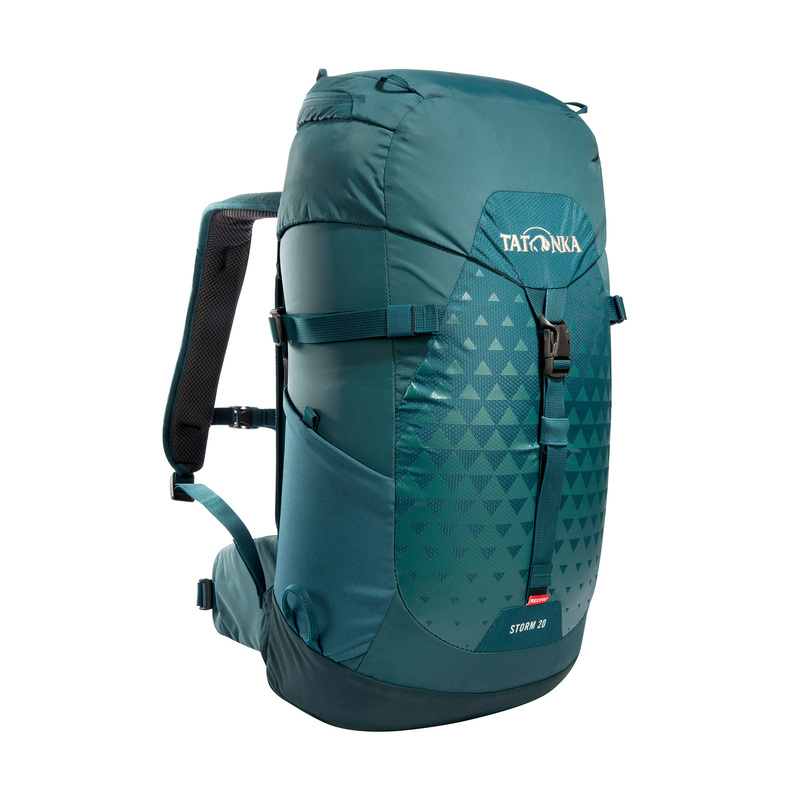
The Tatonka Storm with 20 litre volume and ventilated back system, walking stick holder and rain cover.
From Aschberg the trail then follows the European long-distance hiking trail leading up to Aschberg high plain, from where when the weather is good, there is visibility as far as the Baltic Sea.
In 1930 a seven-meter-high Bismarck monument was erected here. At the foot of the elevation the “Knicklandschaft” Schleswig-Holstein landscape is spread before you: The significant feature is the arrangement of tree and bush hedges laid out like walls, most of them originating from the 18th century. They are above five meters wide and were meant to serve the purpose of “living” fences. The name “Knicklandschaft” refers to the extensive care given to these hedges where branches, shoots and thin twigs are “folded” (Knick) or bent. The hedges are home to numerous varieties of flora and fauna.
Fleckby, the Aschberg and Bistensee can also be starting points for rambles through the 270 square meters of the Nature Park Hüttener Berge, located between the inner Schlei in the north and the North-Baltic Sea Canal in the south in an end moraine area from the last Ice Age. The landscape here is characterized by elevations of up to 100 meters in height and by the lakes Wittensee and Bistensee.
Also interesting: Peloponnese Trekking E4 – Stony treks on the peninsula of the gods
Waterway Ramble: Ascheberg to Sehestedt – 25 kilometers
The Nature Park Trail, like the E1 and the E6, leads down from Ascheberg to the Silberbergen enclosure. Here the long-distance hiking trails turn in the direction of Schleswig; our trail is a path through the woods to the Schoothorster Berg where it then continues to the resort of Bistensee, on the lake of the same name.
From here over field and forest, the route leads through the Duvenstedter Berge area, also formed by the end moraines of the last Ice Age. When the rambler has made his way through the forest around the Heidberg he reaches the village of Borgstedt. This is an ideal starting point to discover the interesting district town and former Rendsburg Fortress by bus or on foot.
Then there is a descent to the Borgstedter Enge, a former river bed of the Eider and the Eider Canal. Close by is also Rader Island which arose during construction of the North Sea-Baltic Sea Canal. The North Sea-Baltic Sea Canal was opened to commercial shipping in 1895 and today is still the most navigated artificial waterway in the world.
Along the Borgstedter Enge and via a commercial canal causeway the tour continues to the little village of Sehestedt with its beautiful simple church from the 13th century. From Sehestedt you can cross the canal by ferry and walk along the Bovenau road for about three kilometers to the manor Gut Kluvensiek: Here you can see the bed of the former Eider Canal of about six kilometers, built between 1777 and 1784, and also a railway bridge with cast iron arches originating from the Carlshütte foundry in Büdelsdorf, the former lock-keeper’s house, the former post station and the remains of the old lock.
Reading tip: Long-distance hiking trails Germany – Hiking pleasure in Germany: the most beautiful routes
A nature monument invites you on a journey through time: day tour from Sehestedt to Westensee – 26 kilometers
On the north bank of the canal the Nature Park Trail continues to the estate Gut Rosenkranz and then to Landwehr, from where you can cross the canal by ferry. You can then ramble along the south bank to the lock, along the lakeside Flemhuder See and the Eider to the B 202 that leads to the village of Achterwehr.
From here the trail leads past the lakes of Westensee and Bosseer See, through settlements, meadows and forests to Westensee with its splendid church from the 13th century. From Achterwehr and Westensee there are wonderful walking routes through the 260 square kilometers of the Nature Park Westensee, characterized by lakes and ponds as well as extensive deciduous and mixed forests.
Especially recommended according to the Ramblers’ Association of North Germany is a stop at the Manor House Emkendorf, where in summer you can listen to concerts or take a guided tour back to the 18th century. Leading past the manor house is a boulevard of 250 year old linden and chestnut trees which has been under a nature conservation order since the mid 1930s.
Other day hikes
- Westensee to Brammer – 19.5 kilometers
- Brammer to Aukrug-Innien – 20.5 kilometers
- Aukrug-Innien to Brokstedt – 20 kilometers
- Brokstedt to Wiemersdorf – 10 kilometers
- Wiemersdorf to Heidmühlen – 17 kilometers
- Heidmühlen to Blunk – 30 kilometers
- Blunk to Bad Segeberg – 10 or 12 kilometers


